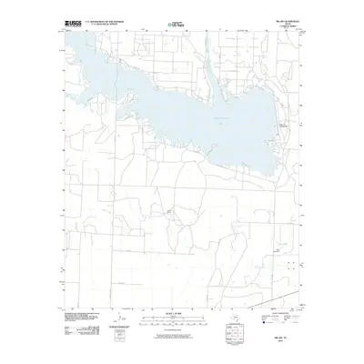
2010 Map of Ira SW
USGS Topo · Published 2010About this map
Lake J B Thomas dominates this West Texas landscape, where the Colorado River is impounded by the Lake J B Thomas Dam. This 2010 survey illustrates the hydrography of Howard County, tracing the finger-like reaches of the lake including the flooded valleys of Wildcat Creek and Sourdough Draw. The terrain is characterized by a network of ranch roads and remote landholdings, most notably the Conrad Ranch situated centrally between the lake and the southern creek beds.
Find a feature on this map
27 named features on this map. Tap any name to fly to it.
Don’t see what you’re looking for? This feature index may not catch every label — zoom into the map to look around manually.
Map Details
Editions of this 2010 Ira SW Map
This is the sole edition of this map. No revisions or reprints were ever made.
Other maps of this area

1942 · Big Spring North
USGS Topo · 1:62,500

1951 · Ira SW
USGS Topo · 1:24,000

1951 · Ira
USGS Topo · 1:24,000

1951 · Ira NW
USGS Topo · 1:24,000

1951 · Vincent
USGS Topo · 1:24,000

1952 · Cuthbert
USGS Topo · 1:24,000

1952 · Ira NE
USGS Topo · 1:24,000

1954 · Big Spring
USGS Topo · 1:250,000

1954 · Big Spring North NE
USGS Topo · 1:24,000

1958 · Big Spring
USGS Topo · 1:250,000