
1968 Map of Irby
USGS Topo · Published 1971About this map
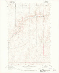
Crab Creek winds through this dry landscape in the late 1960s, creating a corridor of activity for the Burlington Northern railroad and the small settlement of Irby. The map illustrates a region transitioning from the rugged creek bottom to the higher plateau, where an extensive network of wells and gravel pits supports local infrastructure. Further south, the isolated label for Bungalow marks a specific point of habitation amidst the undulating terrain.
Find a feature on this map
21 named features on this map. Tap any name to fly to it.
Don’t see what you’re looking for? This feature index may not catch every label — zoom into the map to look around manually.
Map Details
Editions of this 1968 Irby Map
This is the sole edition of this map. No revisions or reprints were ever made.
Other maps of this area

1925 · Schrag
USGS Topo · 1:62,500

1953 · Ritzville
USGS Topo · 1:250,000

1959 · Ritzville
USGS Topo · 1:250,000

1965 · Ritzville
USGS Topo · 1:250,000
1967 · Ruff
USGS Topo · 1:24,000

1967 · Batum
USGS Topo · 1:24,000

1967 · Reiman
USGS Topo · 1:24,000

1968 · Marlin SW
USGS Topo · 1:24,000

1968 · Marlin
USGS Topo · 1:24,000

1968 · Pacific Lake
USGS Topo · 1:24,000