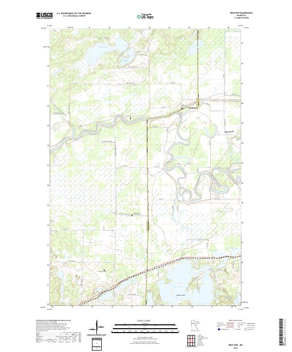
2022 Map of Iron Hub
USGS Topo · Published 2022About this map
The Mississippi River snakes through the center of this landscape, forming the border between Crow Wing and Aitkin Counties as it meanders eastward. This riverine corridor is a focal point for modern recreation and historical transit, marked by the Mississippi River Trail and Mississippi River Drive. The surrounding terrain is defined by a dense network of glacial water bodies, including the sprawling Cedar Lake to the south and Nelson Lake to the north.
Find a feature on this map
69 named features on this map. Tap any name to fly to it.
Don’t see what you’re looking for? This feature index may not catch every label — zoom into the map to look around manually.
Map Details
Editions of this 2022 Iron Hub Map
This is the sole edition of this map. No revisions or reprints were ever made.
Other maps of this area

1912 · Deerwood
USGS Topo · 1:62,500

1913 · Cuyuna
USGS Topo · 1:62,500

1914 · Deerwood
USGS Topo · 1:62,500

1914 · Aitkin
USGS Topo · 1:62,500

1915 · Aitkin
USGS Topo · 1:62,500

1915 · Cuyuna
USGS Topo · 1:62,500

1916 · Wealthwood
USGS Topo · 1:62,500

1953 · Duluth
USGS Topo · 1:250,000

1958 · Duluth
USGS Topo · 1:250,000
1973 · Emily
USGS Topo · 1:24,000