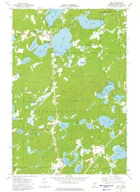
1973 Map of Emily
USGS Topo · Published 1975About this map
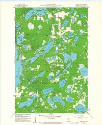
Emily serves as the central hub of this lake-studded landscape in the early 1970s, positioned between the expansive Lake Emily and Ruth Lake. The topography is defined by its post-glacial character, featuring a dense network of water bodies such as Ross Lake, Andrews Lake, and Dahler Lake that are linked by the Little Pine River and Pine River. This survey reveals a community deeply integrated with its natural resources, showing the Emily State Forest and the Crow Wing State Forest spanning large tracts of the territory. Local infrastructure is well-documented for genealogy and history, including the Pine Ridge Cem near the town center and the Township Cem further south. The map also highlights specific landmarks like the Emily Lookout Tower and a Radio Tower, alongside various public access points and shoreline features like Ministers Point and Magbee Island.
Find a feature on this map
49 named features on this map. Tap any name to fly to it.
Don’t see what you’re looking for? This feature index may not catch every label — zoom into the map to look around manually.
Map Details
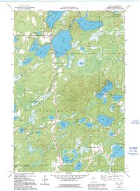
Editions of this 1973 Emily Map
2 editions found
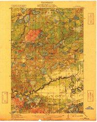
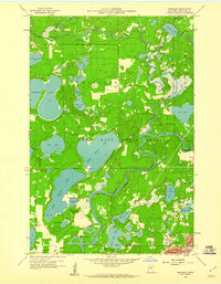
Other maps of this area

1913 · Cuyuna
USGS Topo · 1:62,500
1915 · Cuyuna
USGS Topo · 1:62,500

1953 · Duluth
USGS Topo · 1:250,000

1953 · Brainerd
USGS Topo · 1:250,000

1957 · Brainerd
USGS Topo · 1:250,000

1958 · Brainerd
USGS Topo · 1:250,000

1958 · Duluth
USGS Topo · 1:250,000
1959 · Trommald
USGS Topo · 1:24,000
1960 · Cross Lake
USGS Topo · 1:24,000

1965 · Brainerd
USGS Topo · 1:250,000