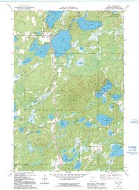
1973 Map of Emily
USGS Topo · Published 1995About this map
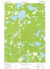
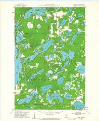
The settlement of Emily sits at the northern nexus of a dense lake system in north-central Minnesota, as documented in this 1970s survey. This glacial landscape is defined by its hydrography, with the Pine River and Little Pine River connecting a series of named water bodies including Lake Emily, Ruth Lake, and Lake Mary. The 1994 revisions highlight the expansion of local infrastructure, showing the Emily Corporate Boundary and various public access points. Significant tracts of the Emily State Forest and Crow Wing State Forest cover much of the terrain, interspersed with early-century landmarks like the Emily Lookout Tower. Local genealogy and land use are reflected in features such as the Pine Ridge Cem, multiple Gravel Pits, and a sprawling network of field lines and fences that illustrate the rural character of Fairfield and Perry townships during this era.
Find a feature on this map
47 named features on this map. Tap any name to fly to it.
Don’t see what you’re looking for? This feature index may not catch every label — zoom into the map to look around manually.
Map Details
Editions of this 1973 Emily Map
2 editions found
Other maps of this area

1913 · Cuyuna
USGS Topo · 1:62,500
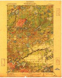
1915 · Cuyuna
USGS Topo · 1:62,500

1953 · Duluth
USGS Topo · 1:250,000

1953 · Brainerd
USGS Topo · 1:250,000

1957 · Brainerd
USGS Topo · 1:250,000

1958 · Brainerd
USGS Topo · 1:250,000

1958 · Duluth
USGS Topo · 1:250,000
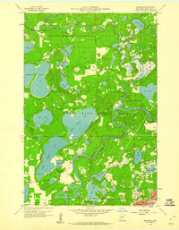
1959 · Trommald
USGS Topo · 1:24,000
1960 · Cross Lake
USGS Topo · 1:24,000

1965 · Brainerd
USGS Topo · 1:250,000