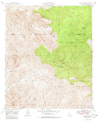
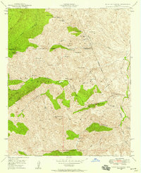
1948 Map of Iron Mountain
USGS Topo · Published 1982About this map
Reevis Ranch and the nearby Reevis Grave anchor this 1948 topographic study of the high-desert terrain within the Tonto National Forest and Crook National Forest. The landscape is defined by deep incisions like Rogers Canyon and Fraser Canyon, which separate prominent summits such as Cimeron Mtn and Mound Mtn. Historical human activity is marked by remote outposts including Woodbury Cabin and the J F Ranch, alongside industrial remnants like the Rogers Troughs (Old Mill). This survey provides significant genealogical and archaeological value, specifically documenting the locations of Cliff Dwellings and numerous natural water sources like Pinto Spring Trough and Whiskey Spr, which were vital for cattle ranching and early habitation in this arid portion of Pinal County.
Find a feature on this map
50 named features on this map. Tap any name to fly to it.
Don’t see what you’re looking for? This feature index may not catch every label — zoom into the map to look around manually.
Map Details
Editions of this 1948 Iron Mountain Map
5 editions found
Other maps of this area

1900 · Florence
USGS Topo · 1:125,000

1902 · Florence
USGS Topo · 1:125,000

1907 · Roosevelt
USGS Topo · 1:125,000

1909 · Four Peaks
USGS Topo · 1:125,000

1912 · Roosevelt
USGS Topo · 1:125,000

1948 · Superior
USGS Topo · 1:62,500

1948 · Superior
USGS Topo · 1:24,000

1948 · Iron Mountain
USGS Topo · 1:24,000
1948 · Haunted Canyon
USGS Topo · 1:24,000

1948 · Picketpost Mtn
USGS Topo · 1:24,000