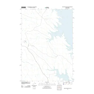
2012 Map of Iron Post Buttes SW
USGS Topo · Published 2012About this map
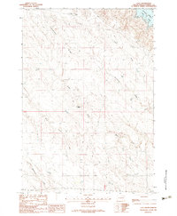
Lake Oahe dominates the eastern landscape of this portion of Stanley County, its sprawling shoreline creating numerous inlets and draws where the Missouri River was impounded. The terrain is defined by the drainage systems of several significant watercourses, including Snake Cr, Chantier Cr, and Deep Cr, which carve through the plains toward the reservoir. Human infrastructure is concentrated along the western corridor, where Agency Creek Rd and Snake Creek Rd provide the primary transit routes across the prairie. Aviation history in this rural area is anchored by the W L Thompson Airport, situated near the headwaters of the Snake Creek drainage. To the south, the winding path of Red Woman Cr meanders toward the lake, illustrating the complex hydrology of this transitional riverine environment.
Find a feature on this map
8 named features on this map. Tap any name to fly to it.
Don’t see what you’re looking for? This feature index may not catch every label — zoom into the map to look around manually.
Map Details
Editions of this 2012 Iron Post Buttes SW Map
This is the sole edition of this map. No revisions or reprints were ever made.
Other maps of this area

1937 · Oahe
USGS Topo · 1:62,500

1954 · Pierre
USGS Topo · 1:250,000

1958 · Pierre
USGS Topo · 1:250,000
1973 · Iron Post Buttes SE
USGS Topo · 1:24,000

1973 · Iron Post Buttes SW
USGS Topo · 1:24,000

1973 · Iron Post Buttes
USGS Topo · 1:24,000
1973 · Willow Creek Butte
USGS Topo · 1:24,000
1973 · Mail Shack Creek
USGS Topo · 1:24,000

1980 · Princes Ranch
USGS Topo · 1:25,000
1982 · Lacy
USGS Topo · 1:24,000