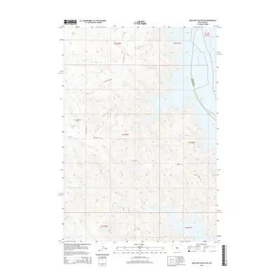
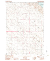
2015 Map of Iron Post Buttes SW
USGS Topo · Published 2015About this map
Lake Oahe dominates the eastern edge of this landscape, where the waters of the Missouri River have transformed the riverine environment of Stanley and Sully Counties. The terrain is defined by deeply carved drainages such as Chantier Cr and Snake Cr, which cut through the high plains toward the reservoir. Local transportation is represented by rural routes like Agency Creek Rd and Snake Creek Rd, which provide access to more remote locations including the Princes Ranch and the W L Thompson Airport. This map illustrates the intersection of mid-century infrastructure and long-standing ranching tradition, showing how Gumbo Rd and SD 1806 navigate the intricate topography of the Missouri breaks. The presence of Deep Cr and Red-Woman Cr further highlights the complex network of seasonal and permanent watercourses that have historically shaped land use in this part of South Dakota.
Find a feature on this map
20 named features on this map. Tap any name to fly to it.
Don’t see what you’re looking for? This feature index may not catch every label — zoom into the map to look around manually.
Map Details
Editions of this 2015 Iron Post Buttes SW Map
This is the sole edition of this map. No revisions or reprints were ever made.
Other maps of this area
1937 · Oahe
USGS Topo · 1:62,500

1954 · Pierre
USGS Topo · 1:250,000

1958 · Pierre
USGS Topo · 1:250,000
1973 · Iron Post Buttes SE
USGS Topo · 1:24,000
1973 · Iron Post Buttes SW
USGS Topo · 1:24,000
1973 · Iron Post Buttes
USGS Topo · 1:24,000
1973 · Willow Creek Butte
USGS Topo · 1:24,000
1973 · Mail Shack Creek
USGS Topo · 1:24,000
1980 · Princes Ranch
USGS Topo · 1:25,000
1982 · Lacy
USGS Topo · 1:24,000