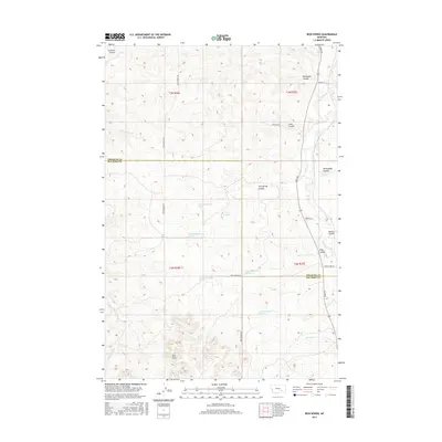
2017 Map of Iron Spring
USGS Topo · Published 2017About this map
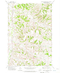
Iron Spring sits at the heart of this landscape, marking a vital water source in the high plains of southern Montana. This survey documents the intersection of Treasure County and Big Horn County, where the terrain is defined by a dense network of coulees that drain toward the Sarpy Cr valley. To the south, the Red Hills rise above the drainage of Cottonwood Cr, illustrating the complex topography that historically dictated the routes of local ranch roads like Iron Springs Rd. The map reveals the intricate drainage patterns of the region, featuring named landmarks such as Coxs Coulee, Willoughby Coulee, and Schrites Coulee. These geographic features and specific spring locations, including several numbered water sources, provide essential context for understanding land use and livestock movement in this part of the Big Horn Basin vicinity during the early twenty-first century.
Find a feature on this map
29 named features on this map. Tap any name to fly to it.
Don’t see what you’re looking for? This feature index may not catch every label — zoom into the map to look around manually.
Map Details
Editions of this 2017 Iron Spring Map
This is the sole edition of this map. No revisions or reprints were ever made.
Other maps of this area

1954 · Hardin
USGS Topo · 1:250,000

1954 · Forsyth
USGS Topo · 1:250,000

1957 · Hardin
USGS Topo · 1:250,000

1957 · Forsyth
USGS Topo · 1:250,000

1958 · Forsyth
USGS Topo · 1:250,000

1958 · Hardin
USGS Topo · 1:250,000
1960 · Hope Ranch
USGS Topo · 1:24,000
1972 · Hammond Ranch
USGS Topo · 1:24,000
1972 · Minnehaha Creek South
USGS Topo · 1:24,000
1972 · Minnehaha Creek North
USGS Topo · 1:24,000