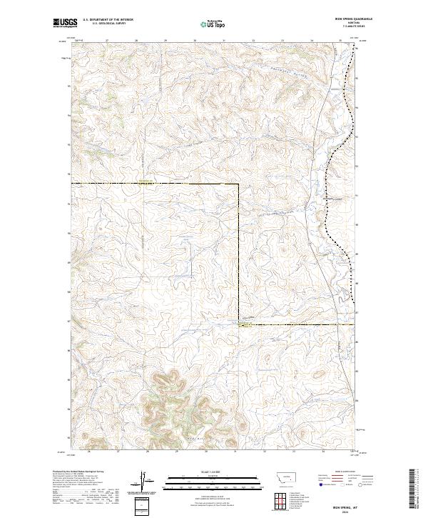
2024 Map of Iron Spring
USGS Topo · Published 2024About this map
Wolf School sits within a landscape defined by deep drainages and intermittent springs on this modern topographical survey of the border between Big Horn and Treasure counties. The terrain is characterized by a series of significant coulees, including Rainwater Coulee, Cox's Coulee, and Iron Spring Coulee, which channel seasonal water toward Sarpy Creek in the east.
Find a feature on this map
34 named features on this map. Tap any name to fly to it.
Don’t see what you’re looking for? This feature index may not catch every label — zoom into the map to look around manually.
Map Details
Editions of this 2024 Iron Spring Map
This is the sole edition of this map. No revisions or reprints were ever made.
Other maps of this area

1954 · Hardin
USGS Topo · 1:250,000

1954 · Forsyth
USGS Topo · 1:250,000

1957 · Hardin
USGS Topo · 1:250,000

1957 · Forsyth
USGS Topo · 1:250,000

1958 · Forsyth
USGS Topo · 1:250,000

1958 · Hardin
USGS Topo · 1:250,000

1960 · Hope Ranch
USGS Topo · 1:24,000

1972 · Hammond Ranch
USGS Topo · 1:24,000

1972 · Minnehaha Creek South
USGS Topo · 1:24,000
1972 · Minnehaha Creek North
USGS Topo · 1:24,000