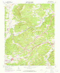
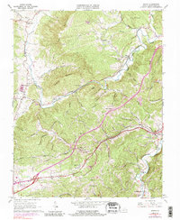
1965 Map of Ironto
USGS Topo · Published 1973About this map
The Norfolk and Western railway corridor dictates the rhythm of settlement through this Virginia landscape, connecting the communities of Shawsville, Montgomery, and Ironto along the valley floor. To the north, the massive prominence of Paris Mountain and Hightop Mountain creates a natural barrier, forcing transport and commerce into the gaps carved by the North Fork Roanoke River. Local history is deeply etched into the hillsides, with family-named hollows like Clinkum Hollow and Slaughterpen Hollow branching off the main drainage. Rural life is anchored by community landmarks such as Halls Ch, Garber Chapel, and Alleghany Ch. In the southern reaches, the waters of Elliott Cr and the South Fork Roanoke River meet near Alleghany Springs, where the terrain begins to climb into the Pedlar Hills. This 1960s survey, with 1970s revisions, documents the evolution of the region as Interchange 37 signals the arrival of modern interstate access.
Find a feature on this map
77 named features on this map. Tap any name to fly to it.
Don’t see what you’re looking for? This feature index may not catch every label — zoom into the map to look around manually.
Map Details
Editions of this 1965 Ironto Map
5 editions found
Other maps of this area

1890 · Christiansburg
USGS Topo · 1:125,000

1923 · Waiteville
USGS Topo · 1:62,500

1929 · Salem
USGS Topo · 1:48,000

1931 · Waiteville
USGS Topo · 1:48,000

1932 · Salem
USGS Topo · 1:62,500

1932 · Blacksburg
USGS Topo · 1:48,000

1937 · Blacksburg
USGS Topo · 1:62,500

1944 · Waiteville
USGS Topo · 1:62,500

1950 · Elliston
USGS Topo · 1:62,500

1951 · Waiteville
USGS Topo · 1:62,500