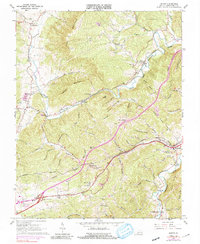
1965 Map of Ironto
USGS Topo · Published 1991About this map
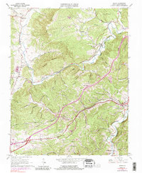
The Norfolk and Western railway corridor dictates the settlement patterns of this Montgomery County landscape, threading through the valleys of the North Fork Roanoke River and South Fork Roanoke River. In the mid-1960s, the community of Shawsville serves as a primary hub, while smaller hamlets like Ironto, Fagg, and Lusters Gate are tucked into the mountain gaps. The map documents a deeply etched topography of ridges and hollows, including Paris Mountain and Hightop Mountain, where numerous family-named landmarks like Slaughterpen Hollow and Ryan Hollow reside.
Find a feature on this map
75 named features on this map. Tap any name to fly to it.
Don’t see what you’re looking for? This feature index may not catch every label — zoom into the map to look around manually.
Map Details
Editions of this 1965 Ironto Map
5 editions found
Other maps of this area

1890 · Christiansburg
USGS Topo · 1:125,000

1923 · Waiteville
USGS Topo · 1:62,500

1929 · Salem
USGS Topo · 1:48,000

1931 · Waiteville
USGS Topo · 1:48,000

1932 · Salem
USGS Topo · 1:62,500

1932 · Blacksburg
USGS Topo · 1:48,000

1937 · Blacksburg
USGS Topo · 1:62,500

1944 · Waiteville
USGS Topo · 1:62,500

1950 · Elliston
USGS Topo · 1:62,500

1951 · Waiteville
USGS Topo · 1:62,500