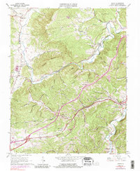
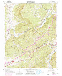
1965 Map of Ironto
USGS Topo · Published 1991About this map
The North Fork Roanoke River carves a winding path through the valley floors of Montgomery County, anchoring a landscape defined by the Norfolk and Western railway. This mid-1960s snapshot shows the corridor of industry and transport following the river bends, connecting settlements like Ironto and Shawsville. The terrain is deeply corrugated by family-named hollows, including Taylor Hollow, Iron Mine Hollow, and Coffee Valley, suggesting a long history of local land use and resource extraction.
Find a feature on this map
72 named features on this map. Tap any name to fly to it.
Don’t see what you’re looking for? This feature index may not catch every label — zoom into the map to look around manually.
Map Details
Editions of this 1965 Ironto Map
5 editions found
Other maps of this area

1890 · Christiansburg
USGS Topo · 1:125,000

1923 · Waiteville
USGS Topo · 1:62,500

1929 · Salem
USGS Topo · 1:48,000

1931 · Waiteville
USGS Topo · 1:48,000

1932 · Salem
USGS Topo · 1:62,500

1932 · Blacksburg
USGS Topo · 1:48,000

1937 · Blacksburg
USGS Topo · 1:62,500

1944 · Waiteville
USGS Topo · 1:62,500

1950 · Elliston
USGS Topo · 1:62,500

1951 · Waiteville
USGS Topo · 1:62,500