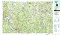
1981 Map of Ironton
USGS Topo · Published 1982About this map
The Ohio River valley serves as the central artery for this tri-state region, where the industrial and natural landscapes of Ohio, West Virginia, and Kentucky converge. In the early 1980s, the area's economic foundations are visible through the extensive rail networks of the B & O RR and N & W RR that parallel the riverbanks. The map documents the persistent legacy of the region's iron industry with locations like Harrison Furnace and Scioto Furnace, while simultaneously highlighting the massive federal footprint of the U.S. Reservation Atomic Energy Commission. This industrial presence is balanced by the vast wooded tracts of the Wayne National Forest and the Cooper Hollow Wildlife Area, illustrating a landscape of heavy industry surrounded by managed wilderness and recreational spaces like Greenbo Lake State Resort Park.
Find a feature on this map
132 named features on this map. Tap any name to fly to it.
Don’t see what you’re looking for? This feature index may not catch every label — zoom into the map to look around manually.
Map Details
Editions of this 1981 Ironton Map
This is the sole edition of this map. No revisions or reprints were ever made.
Other maps of this area

1892 · Huntington
USGS Topo · 1:125,000

1898 · Huntington
USGS Topo · 1:125,000

1898 · Ironton
USGS Topo · 1:62,500

1899 · Charleston
USGS Topo · 1:125,000

1900 · Ironton
USGS Topo · 1:62,500

1901 · Guyandot
USGS Topo · 1:62,500

1901 · Ceredo
USGS Topo · 1:62,500

1902 · Guyandot
USGS Topo · 1:62,500

1902 · Milton
USGS Topo · 1:62,500

1903 · Kenova
USGS Topo · 1:125,000