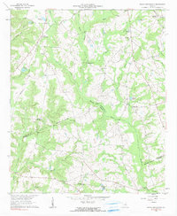
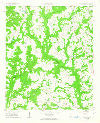
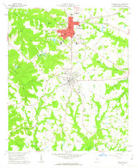
1962 Map of Irwins Crossroads
USGS Topo · Published 1991About this map
Irwins Crossroads and Peacocks Crossing serve as the primary hubs for this rural landscape along the Washington and Johnson County line. The map reveals a deeply rooted community structure defined by numerous country churches and cemeteries, such as Bethesda Ch, Mt Gilead Ch, and Smith Grove Cem. The Ohoopee River and its many tributaries, including Dyers Creek and Little Buckeye Creek, dictate the geography of the area, punctuated by small fishing spots like Andrews Pond and Youngs Pond. A notable historical transit corridor is visible in the Old Savannah Road, which cuts across the northern terrain. The distribution of family-named landmarks and river crossings like Harts Ford Bridge suggests a long-standing agricultural and timber-based economy where local waterways and early road networks remained central to daily life in the mid-20th century.
Find a feature on this map
41 named features on this map. Tap any name to fly to it.
Don’t see what you’re looking for? This feature index may not catch every label — zoom into the map to look around manually.
Map Details
Editions of this 1962 Irwins Crossroads Map
2 editions found
Other maps of this area

1957 · Macon
USGS Topo · 1:250,000

1958 · Macon
USGS Topo · 1:250,000
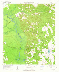
1962 · Oconee
USGS Topo · 1:24,000
1962 · Irwins Crossroads
USGS Topo · 1:24,000
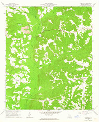
1962 · Tabernacle
USGS Topo · 1:24,000
1962 · Sandersville
USGS Topo · 1:24,000

1964 · Macon
USGS Topo · 1:250,000
1973 · Riddleville
USGS Topo · 1:24,000
1973 · Harrison
USGS Topo · 1:24,000
1974 · Cow Hell Swamp
USGS Topo · 1:24,000