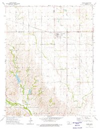
1973 Map of Isabel
USGS Topo · Published 1975About this map
Isabel serves as the primary hub of this south-central Kansas landscape, situated along the Atchison Topeka and Santa Fe railroad line. The settlement is positioned near the Pratt Co Barber Co boundary, reflecting the agricultural and transit-oriented development of the early 1970s. South of the town, the Isabel Cem sits quietly above the broad Elm Mills Valley, a region defined by its complex drainage network. Water is a defining feature here, from the meandering Sand Creek in the north to the southern reaches of Elm Creek and the recreational waters of Lake Arrowhead. The map details a transition from the structured township grids of TWP 11 into the more irregular terrain of the Medicine Lodge area, where numerous smaller tributaries like Chicken Creek and Stohr Cr carve into the prairie floor.
Find a feature on this map
20 named features on this map. Tap any name to fly to it.
Don’t see what you’re looking for? This feature index may not catch every label — zoom into the map to look around manually.
Map Details
Editions of this 1973 Isabel Map
This is the sole edition of this map. No revisions or reprints were ever made.
Other maps of this area

1889 · Anthony
USGS Topo · 1:125,000

1891 · Medicine Lodge
USGS Topo · 1:125,000

1891 · Anthony
USGS Topo · 1:125,000

1892 · Kingman
USGS Topo · 1:125,000

1892 · Pratt
USGS Topo · 1:125,000

1893 · Medicine Lodge
USGS Topo · 1:125,000

1894 · Kingman
USGS Topo · 1:125,000

1894 · Pratt
USGS Topo · 1:125,000

1955 · Pratt
USGS Topo · 1:250,000

1959 · Pratt
USGS Topo · 1:250,000