Loading...
Loading map...1941 Map of Isabela
USGS Topo · Published 1941About this map
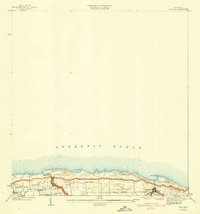
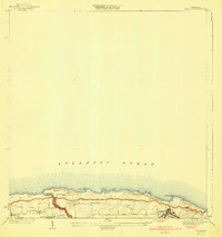
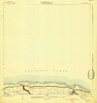
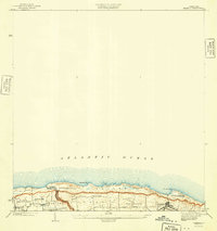
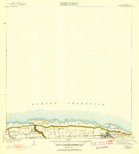
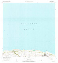
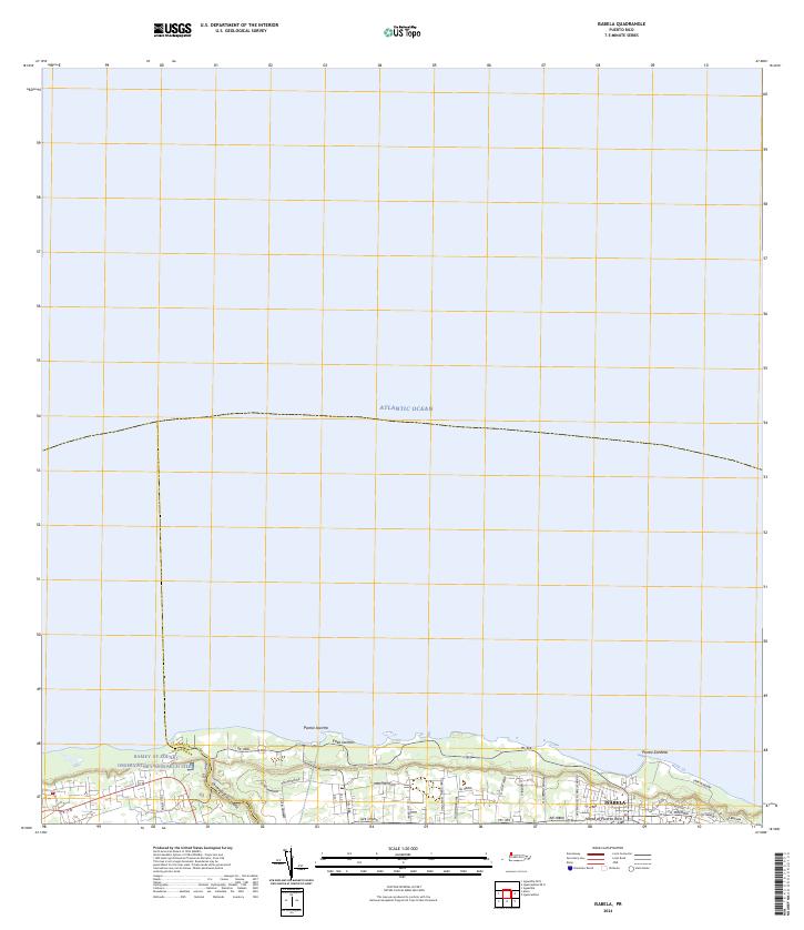
Isabela and its surrounding barrios are surveyed here just before the mid-century, revealing a coastal landscape defined by its agricultural layout and early transportation infrastructure. The A RR of PR rail line cuts through the southern portion of the town, marking the importance of rail transit for this region of Puerto Rico. Along the northern coast, prominent landforms like Pta Jacinto and Pta Sardina meet the Atlantic Ocean, while the interior is dotted with established communities including Maleza Alta, Aguacate, and Bejucos.
Find a feature on this map
19 named features on this map. Tap any name to fly to it.
Don’t see what you’re looking for? This feature index may not catch every label — zoom into the map to look around manually.
Map Details
Date Portrayed1941
Date Published1941
PublisherU.S. Geological Survey
Map TypeTopographic
Scale1:30,000
Physical Dimensions19.7 x 21 inches
Editions of this 1941 Isabela Map
5 editions found
Historical Maps of Isabela Through Time
5 maps found
Featured Locations
- Isabela, Isabela
- Jardín Miramar, Isabela
- Bajura, Isabela
- Sector Quique Bravo, Isabela
- Reparto Santa María, Isabela
Source Details
SourceU.S. Geological Survey
CopyrightPublic Domain