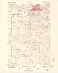
1952 Map of Ishpeming
USGS Topo · Published 1954About this map
The iron-rich hills of the Marquette Range define this landscape in the early 1950s, centered on the industrial hub of Ishpeming. The urban center is dense with civil infrastructure including a Hospital and High Sch, while the surrounding terrain is marked by the heavy footprint of the mining industry. Large Mine Dumps and active operations like Tilden Mine and the settlement at National Mine reveal the intensive extraction occurring during this era.
Find a feature on this map
49 named features on this map. Tap any name to fly to it.
Don’t see what you’re looking for? This feature index may not catch every label — zoom into the map to look around manually.
Map Details
Editions of this 1952 Ishpeming Map
4 editions found
Other maps of this area

1952 · Ishpeming
USGS Topo · 1:62,500

1952 · Ishpeming
USGS Topo · 1:24,000

1952 · Palmer
USGS Topo · 1:24,000

1953 · Negaunee
USGS Topo · 1:24,000

1954 · Negaunee SW
USGS Topo · 1:24,000

1954 · Negaunee
USGS Topo · 1:62,500

1955 · Diorite
USGS Topo · 1:24,000

1955 · Greenwood
USGS Topo · 1:24,000

1955 · Republic
USGS Topo · 1:62,500

1955 · Champion
USGS Topo · 1:62,500