
1964 Map of Island Park Dam
USGS Topo · Published 1966About this map
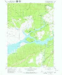
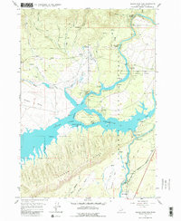
Island Park Reservoir dominates this mid-1960s survey of Fremont County, showing the impounded waters of the Henrys Fork behind the Island Park Dam. The map details a landscape transitioning from traditional ranching to mid-century recreation, as evidenced by the mix of older landmarks like McCrea Ranch and several modern recreational sites such as McCrea Bridge Campground and Jackson Landing Campground. The geography is defined by the sharp descent from Thurmon Ridge toward the reservoir and the dramatic Box Canyon to the south. Notable hydrological features include the Coffee Pot Rapids on the river's upper reaches and the confluence of the Buffalo River. For those researching local history, the map provides precise locations for Gravel Pits and gaging stations, alongside the distinct residential footprint of I P Bills Island.
Find a feature on this map
45 named features on this map. Tap any name to fly to it.
Don’t see what you’re looking for? This feature index may not catch every label — zoom into the map to look around manually.
Map Details
Editions of this 1964 Island Park Dam Map
3 editions found
Other maps of this area

1950 · Upper Red Rock Lake
USGS Topo · 1:62,500

1955 · Ashton
USGS Topo · 1:250,000

1958 · Ashton
USGS Topo · 1:250,000

1960 · Ashton
USGS Topo · 1:250,000

1964 · Hatchery Butte
USGS Topo · 1:24,000

1964 · Island Park
USGS Topo · 1:24,000

1964 · Sawtell PK
USGS Topo · 1:24,000

1964 · Big Springs
USGS Topo · 1:24,000

1964 · Last Chance
USGS Topo · 1:24,000

1964 · Henrys Lake
USGS Topo · 1:62,500