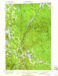
1953 Map of Island Pond
USGS Topo · Published 1960About this map
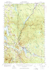
Island Pond serves as the primary hub of this Vermont border region, where the Canadian National railroad tracks cut through the dense forests of Essex County. In the mid-1950s, this landscape was defined by its remote glacial lakes and isolated timber tracts, such as Warrens Gore and Avery S Gore. The map reveals a network of water-dependent settlements and specialized sites, from the State Fish Hatchery near Morgan Center to the international crossing at Norton Mills on the Canadian border.
Find a feature on this map
106 named features on this map. Tap any name to fly to it.
Don’t see what you’re looking for? This feature index may not catch every label — zoom into the map to look around manually.
Map Details
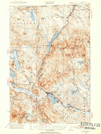
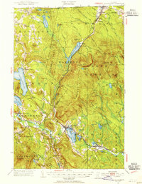
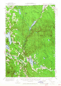
Editions of this 1953 Island Pond Map
5 editions found
Other maps of this area

1919 · Lake Memphremagog
USGS Topo · 1:62,500

1920 · Derby
USGS Topo · 1:62,500

1920 · Guildhall
USGS Topo · 1:62,500

1923 · Lake Memphremagog
USGS Topo · 1:48,000

1924 · Island Pond
USGS Topo · 1:48,000

1925 · Memphremagog
USGS Topo · 1:62,500

1926 · Island Pond
USGS Topo · 1:62,500

1929 · Averill
USGS Topo · 1:62,500

1931 · Guildhall
USGS Topo · 1:48,000

1933 · Guildhall
USGS Topo · 1:48,000