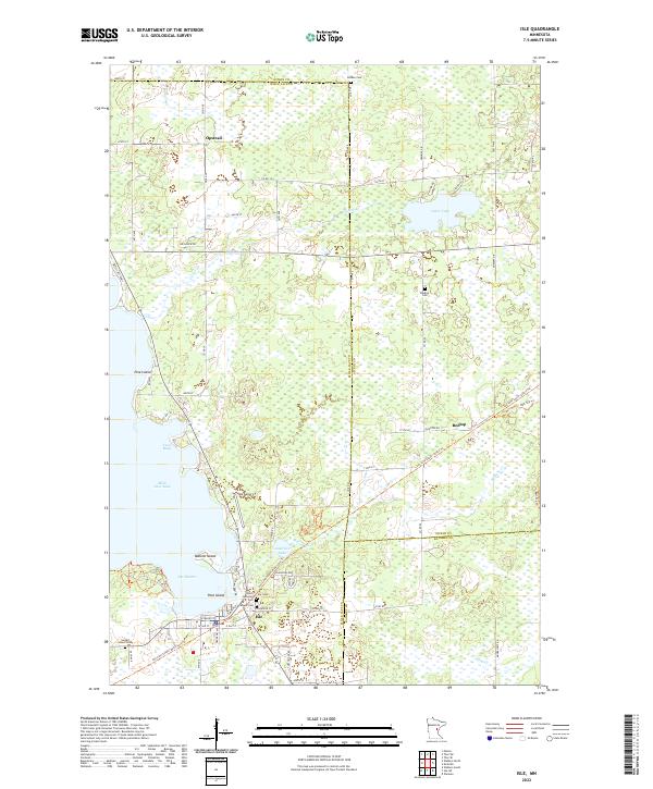
2022 Map of Isle
USGS Topo · Published 2022About this map
Isle sits at the southeastern corner of the expansive Mille Lacs Lake, serving as a focal point for this lakeshore landscape. This survey documents the area's intricate water network, from the sheltered Twin Bays and Isle Harbor to the interior drainage of Cedar Cr and Malone Cr. The presence of the Soo Line South: Aitkin Trl indicates the legacy of the regional rail network, now repurposed for trail use through the mixed forest and wetland terrain.
Find a feature on this map
75 named features on this map. Tap any name to fly to it.
Don’t see what you’re looking for? This feature index may not catch every label — zoom into the map to look around manually.
Map Details
Editions of this 2022 Isle Map
This is the sole edition of this map. No revisions or reprints were ever made.
Other maps of this area

1916 · Wealthwood
USGS Topo · 1:62,500

1953 · Duluth
USGS Topo · 1:250,000

1958 · Duluth
USGS Topo · 1:250,000

1968 · Isle SW
USGS Topo · 1:24,000

1968 · Wahkon North
USGS Topo · 1:24,000

1968 · Isle
USGS Topo · 1:24,000

1968 · Warman
USGS Topo · 1:24,000
1968 · Wahkon South
USGS Topo · 1:24,000

1968 · Mc Grath
USGS Topo · 1:24,000

1969 · Thor SE
USGS Topo · 1:24,000