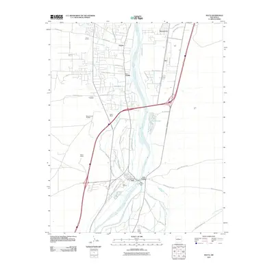
2010 Map of Isleta
USGS Topo · Published 2010About this map
Isleta Pueblo serves as a central anchor in this 2010 topographic record, situated along the banks of the Rio Grande. The landscape is defined by its complex irrigation network, featuring an intricate system of canals and ditches such as the Isleta Indian Lateral, Chical Ditch, and Butte Lateral. These waterways, managed by the Isleta Diversion Dam, highlight the enduring agricultural traditions of the valley. Settlement patterns follow the river and the base of prominent geological features like Black Mesa and Mesa de los Padillas. Genealogists and local historians will find significant detail in the residential layouts of Pajarito, Barr, and Los Padillas, alongside dedicated sites like Isleta Cemetery and the Chical Indian School. The presence of the Mc Elroy Pit and State Pit suggests ongoing local industry and resource extraction near the established communities and transportation corridors.
Find a feature on this map
63 named features on this map. Tap any name to fly to it.
Don’t see what you’re looking for? This feature index may not catch every label — zoom into the map to look around manually.
Map Details
Editions of this 2010 Isleta Map
This is the sole edition of this map. No revisions or reprints were ever made.
Other maps of this area

1888 · Bernalillo
USGS Topo · 1:125,000

1889 · Albuquerque
USGS Topo · 1:125,000

1893 · Albuquerque
USGS Topo · 1:125,000

1934 · West Albuquerque
USGS Topo · 1:24,000

1934 · East Albuquerque
USGS Topo · 1:24,000

1938 · Albuquerque
USGS Topo · 1:62,500

1952 · Wind Mesa
USGS Topo · 1:24,000

1952 · Dalies
USGS Topo · 1:24,000

1952 · Hubbell Spring
USGS Topo · 1:24,000

1952 · Los Lunas SE
USGS Topo · 1:24,000