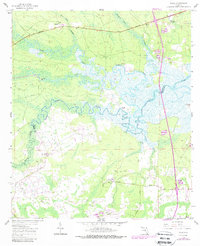
1958 Map of Italia
USGS Topo · Published 1988About this map
Italia and Hero sit near the northern boundary of this landscape, where the Nassau River system creates a complex network of wetlands and tidal creeks. The 1958 survey captures a rural stretch of the Florida-Georgia borderlands dominated by vast drainage systems like Tom Mann Swamp and Plummer Creek. Water-access points such as Seaton Landing, Joe's Landing, and West Landing reflect a long history of river-based transport and navigation along Thomas Creek.
Find a feature on this map
29 named features on this map. Tap any name to fly to it.
Don’t see what you’re looking for? This feature index may not catch every label — zoom into the map to look around manually.
Map Details
Editions of this 1958 Italia Map
4 editions found
Other maps of this area

1917 · Cambon
USGS Topo · 1:62,500

1917 · Hilliard
USGS Topo · 1:62,500

1918 · St Marys
USGS Topo · 1:62,500

1918 · Cambon
USGS Topo · 1:62,500

1918 · Jacksonville
USGS Topo · 1:62,500

1919 · St Marys
USGS Topo · 1:62,500

1919 · Hilliard
USGS Topo · 1:62,500

1948 · Jacksonville
USGS Topo · 1:250,000

1948 · Eastport
USGS Topo · 1:24,000

1950 · Trout River
USGS Topo · 1:24,000