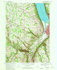
1969 Map of Ithaca West
USGS Topo · Published 1971About this map
Ithaca sits at the southern tip of Cayuga Lake, where the Inlet and Fall Creek meet the water at Stewart Park. In the late 1960s, the city's western edge is defined by the steep grades of Cliff Park and the winding course of Cascadilla Creek. The landscape transitions from the urban core at Buffalo St and State St to a series of rural hamlets marked by family names, including Whipple Corner, Kennedy Corner, and Applegate Corner. The presence of numerous Gravel Pits and the Lehigh Valley railroad tracks through the valley floor reflects the era's local industry.
Find a feature on this map
89 named features on this map. Tap any name to fly to it.
Don’t see what you’re looking for? This feature index may not catch every label — zoom into the map to look around manually.
Map Details
Editions of this 1969 Ithaca West Map
2 editions found
Other maps of this area

1893 · Ithaca
USGS Topo · 1:62,500

1895 · Ithaca
USGS Topo · 1:62,500

1898 · Moravia
USGS Topo · 1:62,500

1900 · Dryden
USGS Topo · 1:62,500

1902 · Moravia
USGS Topo · 1:62,500

1902 · Genoa
USGS Topo · 1:62,500

1905 · Watkins Glen
USGS Topo · 1:125,000

1906 · Catatonk
USGS Topo · 1:125,000

1942 · Ludlowville
USGS Topo · 1:24,000

1942 · Trumansburg
USGS Topo · 1:24,000