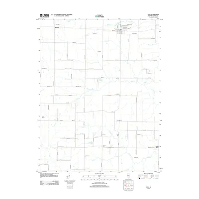
2012 Map of Iuka
USGS Topo · Published 2012About this map
Iuka serves as a central hub in this agricultural landscape of eastern Marion County, where a dense network of family and community burial grounds provides a clear record of 19th and 20th-century settlement. Numerous sites including Old Bethel Cem, Snow Hill Cem, and Barrall Cem are scattered across the section lines, often situated near small watercourses like Paintrock Cr and Fulton Cr. The village of Bannister sits to the northwest, while the small cluster of Union Town occupies the southeastern corner near the Skillet Fork drainage.
Find a feature on this map
101 named features on this map. Tap any name to fly to it.
Don’t see what you’re looking for? This feature index may not catch every label — zoom into the map to look around manually.
Map Details
Editions of this 2012 Iuka Map
This is the sole edition of this map. No revisions or reprints were ever made.
Other maps of this area

1933 · Mount Vernon
USGS Topo · 1:48,000

1934 · Salem
USGS Topo · 1:62,500

1938 · Salem
USGS Topo · 1:62,500

1940 · Mount Vernon
USGS Topo · 1:62,500

1947 · Wayne City
USGS Topo · 1:62,500

1952 · Xenia
USGS Topo · 1:62,500

1958 · Belleville
USGS Topo · 1:250,000

1962 · Belleville
USGS Topo · 1:250,000

1965 · Iuka
USGS Topo · 1:24,000
1965 · Salem South
USGS Topo · 1:24,000