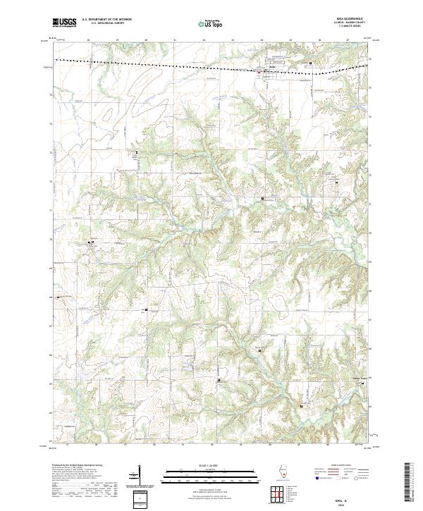
2024 Map of Iuka
USGS Topo · Published 2024About this map
Iuka stands at a primary crossroads in eastern Marion County, where the grid of rural roads meets the legacy of the local cemetery network. The landscape is defined by the winding tributaries of Crooked Creek and Paintrock Creek, which carve through the terrain and create natural pockets for small community landmarks. A significant number of family and church-affiliated burial grounds, including Old Bethel Cem, Trinity Lutheran Cem, and Rabbit Grove Cem, are distributed across the township, providing a clear spatial record for genealogical research. To the southeast, the settlement of Union Town sits near the banks of Paintrock Creek, while local water bodies like Lester Lake and Goostree Lake break the regularity of the section lines. The dense network of country roads such as Apple Ridge Rd and Mud Rd connects these points of interest, reflecting the enduring rural character of this Illinois corridor.
Find a feature on this map
77 named features on this map. Tap any name to fly to it.
Don’t see what you’re looking for? This feature index may not catch every label — zoom into the map to look around manually.
Map Details
Editions of this 2024 Iuka Map
This is the sole edition of this map. No revisions or reprints were ever made.
Other maps of this area

1933 · Mount Vernon
USGS Topo · 1:48,000

1934 · Salem
USGS Topo · 1:62,500

1938 · Salem
USGS Topo · 1:62,500

1940 · Mount Vernon
USGS Topo · 1:62,500

1947 · Wayne City
USGS Topo · 1:62,500

1952 · Xenia
USGS Topo · 1:62,500

1958 · Belleville
USGS Topo · 1:250,000

1962 · Belleville
USGS Topo · 1:250,000

1965 · Iuka
USGS Topo · 1:24,000
1965 · Salem South
USGS Topo · 1:24,000