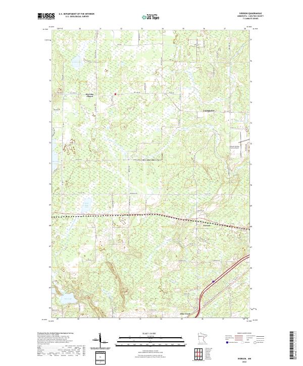
2022 Map of Iverson
USGS Topo · Published 2022About this map
Iverson and its surrounding wetlands and waterways characterize this Carlton County landscape, where the Moose Horn River and Otter Creek wind through a mosaic of lakes and marshland. The settlement pattern is defined by a grid of rural roads like Lund Rd and Big Lake Rd, reflecting the late-twentieth-century residential and recreational development of northern Minnesota. Central to the community is the Big Lake Chapel, positioned near the shores of Big Lake, serving as a local landmark alongside more modern infrastructure like the Cloquet Carlton County Airport.
Find a feature on this map
69 named features on this map. Tap any name to fly to it.
Don’t see what you’re looking for? This feature index may not catch every label — zoom into the map to look around manually.
Map Details
Editions of this 2022 Iverson Map
This is the sole edition of this map. No revisions or reprints were ever made.
Other maps of this area

1953 · Saginaw
USGS Topo · 1:24,000

1953 · Brookston
USGS Topo · 1:24,000

1953 · Duluth
USGS Topo · 1:250,000

1954 · Cloquet
USGS Topo · 1:24,000

1954 · Wrenshall
USGS Topo · 1:24,000

1954 · Atkinson
USGS Topo · 1:24,000

1954 · Iverson
USGS Topo · 1:24,000

1954 · Sawyer
USGS Topo · 1:24,000

1954 · Martin Lake
USGS Topo · 1:24,000

1956 · Barnum
USGS Topo · 1:62,500