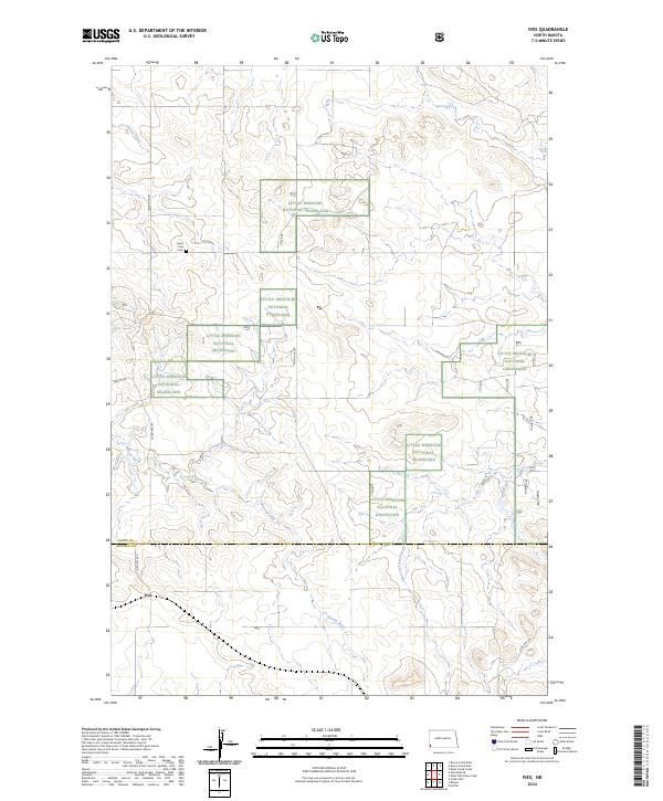
2024 Map of Ives
USGS Topo · Published 2024About this map
Little Missouri National Grassland segments dominate this southwestern North Dakota landscape, where the prairie is etched by seasonal watercourses and rural section roads. The small settlement of Ives sits at the southwestern edge of the quadrangle, serving as a rare point of human density in a region defined by open ranchland and public trust lands. Genealogists and local historians can locate the Saint Paul Cem, a solitary landmark positioned near Indian Creek in the northwestern quadrant. The map also delineates the border between Slope Co and Bowman Co, revealing how drainage patterns like Bacon Creek and West Fork Deep Creek move across the county line. This contemporary survey captures the enduring rural character of the area, where historic routes like Fort Dilts Rd continue to navigate the undulating terrain.
Find a feature on this map
19 named features on this map. Tap any name to fly to it.
Don’t see what you’re looking for? This feature index may not catch every label — zoom into the map to look around manually.
Map Details
Editions of this 2024 Ives Map
This is the sole edition of this map. No revisions or reprints were ever made.
Other maps of this area

1953 · Dickinson
USGS Topo · 1:250,000

1957 · Dickinson
USGS Topo · 1:250,000

1973 · Griffin
USGS Topo · 1:24,000

1973 · Cedar Hills
USGS Topo · 1:24,000

1973 · Rhame
USGS Topo · 1:24,000

1979 · Ives
USGS Topo · 1:24,000

1980 · Boyce Creek West
USGS Topo · 1:24,000

1981 · Bowman
USGS Topo · 1:100,000
1997 · Boyce Creek West
USGS Topo · 1:24,000
1997 · Marmarth SE
USGS Topo · 1:24,000