
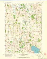
1959 Map of Ixonia
USGS Topo · Published 1961About this map
The Rock River meanders through the heart of this landscape at the intersection of Dodge, Jefferson, and Waukesha counties, defining a terrain shaped by winding waterways and agricultural plateaus. The village of Ixonia serves as a primary rail hub, situated along the Chicago Milwaukee St Paul and Pacific line, while further north, the distinct communities of Old Ashippun and New Ashippun reveal the shifting centers of local commerce and settlement.
Find a feature on this map
42 named features on this map. Tap any name to fly to it.
Don’t see what you’re looking for? This feature index may not catch every label — zoom into the map to look around manually.
Map Details
Editions of this 1959 Ixonia Map
2 editions found
Other maps of this area

1892 · Watertown
USGS Topo · 1:62,500

1892 · Oconomowoc
USGS Topo · 1:62,500

1894 · Watertown
USGS Topo · 1:62,500

1904 · Hartford
USGS Topo · 1:62,500

1909 · Oconomowoc
USGS Topo · 1:62,500

1955 · Horicon
USGS Topo · 1:62,500

1957 · Madison
USGS Topo · 1:250,000
1959 · Helenville
USGS Topo · 1:24,000
1959 · Oconomowoc East
USGS Topo · 1:24,000
1959 · Stonebank
USGS Topo · 1:24,000