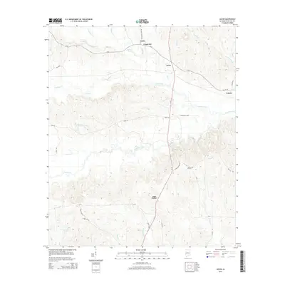
2014 Map of Jachin
USGS Topo · Published 2014About this map
Jachin serves as a central point in this rural Choctaw County landscape, where the intersection of Al-17 and Al-156 connects small communities and agricultural lands. The terrain is deeply defined by a complex drainage network, notably Yantley Creek and Tuckabum Creek, which carve through the wooded hills. To the north, the settlement of Chapel Hill is anchored by the Christopher Chapel Cem, while the southern reaches near Little Walker show a pattern of local roads like Bent Tree Rd and Linder Rd winding through the timberland.
Find a feature on this map
45 named features on this map. Tap any name to fly to it.
Don’t see what you’re looking for? This feature index may not catch every label — zoom into the map to look around manually.
Map Details
Editions of this 2014 Jachin Map
This is the sole edition of this map. No revisions or reprints were ever made.
Other maps of this area

1953 · Meridian
USGS Topo · 1:250,000

1957 · Meridian
USGS Topo · 1:250,000

1965 · Meridian
USGS Topo · 1:250,000

1971 · Whitfield
USGS Topo · 1:24,000

1971 · Gaston
USGS Topo · 1:24,000

1974 · Ward
USGS Topo · 1:24,000

1974 · Lisman
USGS Topo · 1:24,000
1974 · Land
USGS Topo · 1:24,000
1978 · Pennington
USGS Topo · 1:24,000
1978 · Putnam
USGS Topo · 1:24,000