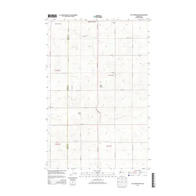
2013 Map of Jack Woods Butte
USGS Topo · Published 2013About this map
The boundary between Grant and Lincoln counties divides this high plateau landscape, dominated by agricultural tracks and prominent drainage draws. Bagdad Junction stands at the northern edge of the sheet, while the Grand Coulee Grange serves as a community anchor for the surrounding rural territory. The terrain is defined by the elevation of Jack Woods Butte, which overlooks a network of seasonal watercourses including Devils Creek and the deep incisions of Klobuschar Draw. Genealogists and local historians will find the Lafollette Cemetery located centrally along Lafollette Road North. The map also traces several family-named routes such as Kramer Road East and Childers Road East, illustrating the pattern of land ownership and agricultural development in this part of Washington.
Find a feature on this map
35 named features on this map. Tap any name to fly to it.
Don’t see what you’re looking for? This feature index may not catch every label — zoom into the map to look around manually.
Map Details
Editions of this 2013 Jack Woods Butte Map
This is the sole edition of this map. No revisions or reprints were ever made.
Other maps of this area

1948 · Grand Coulee Dam
USGS Topo · 1:62,500

1950 · Grand Coulee Dam
USGS Topo · 1:62,500

1953 · Ritzville
USGS Topo · 1:250,000

1959 · Ritzville
USGS Topo · 1:250,000

1965 · Ritzville
USGS Topo · 1:250,000

1968 · Hartline
USGS Topo · 1:24,000

1968 · Steamboat Rock SE
USGS Topo · 1:24,000
1968 · Electric City
USGS Topo · 1:24,000

1969 · Almira
USGS Topo · 1:24,000

1969 · Govan
USGS Topo · 1:24,000