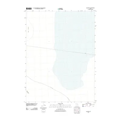
2011 Map of Jackson
USGS Topo · Published 2011About this map
Pigeon Mountain rises in the northwestern corner of this territory, overlooking the stark, expansive landscape of Box Elder County. This 2011 survey illustrates the sparse infrastructure characteristic of this arid region, where the Little Pigeon Rd provides the primary transit route through the southern reaches. The map identifies the small locale of Jackson, positioned along a road that traverses the eastern edge of the quadrangle. The terrain is defined by the sharp transition between the low-lying basins and the elevated outcrops of the Little Pigeon Mountains. This documentation captures the area's remote character, preserving the exact placement of local roads and landforms during the early 21st century for researchers and land-use historians.
Find a feature on this map
4 named features on this map. Tap any name to fly to it.
Don’t see what you’re looking for? This feature index may not catch every label — zoom into the map to look around manually.
Map Details
Editions of this 2011 Jackson Map
This is the sole edition of this map. No revisions or reprints were ever made.
Other maps of this area

1954 · Brigham City
USGS Topo · 1:250,000

1958 · Brigham City
USGS Topo · 1:250,000

1962 · Brigham City
USGS Topo · 1:250,000

1967 · Pigeon Mountain
USGS Topo · 1:24,000

1967 · Lucin NE
USGS Topo · 1:24,000

1967 · Lemay Island
USGS Topo · 1:24,000

1983 · Jackson
USGS Topo · 1:24,000

1983 · Bovine SE
USGS Topo · 1:24,000

1983 · Terrace Mountain West
USGS Topo · 1:24,000

1983 · Lucin 4 NE
USGS Topo · 1:24,000