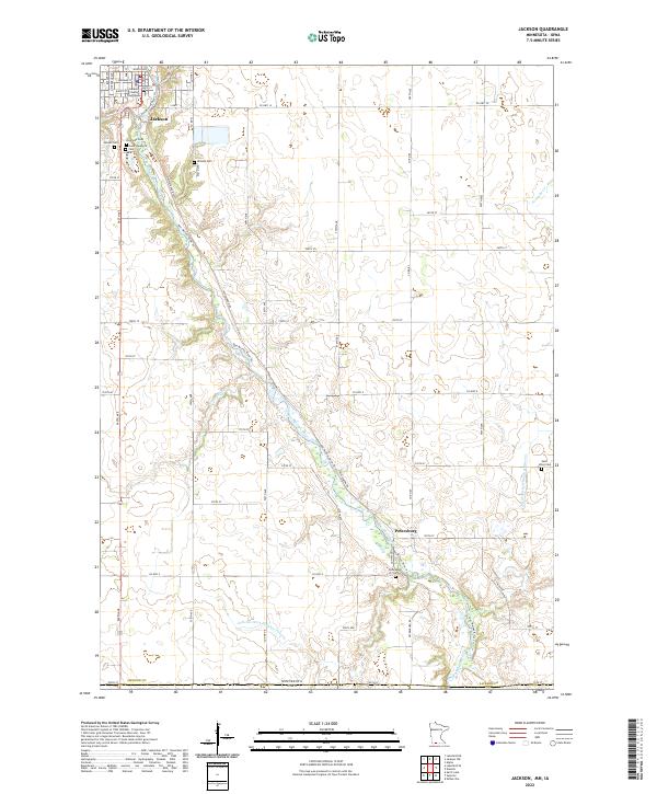
2022 Map of Jackson
USGS Topo · Published 2022About this map
Jackson serves as the focal point of this southwestern Minnesota landscape, where the Jackson County Courthouse stands near the banks of the Des Moines River. The terrain is defined by the winding river valley and an extensive network of water management features, including Judicial Ditch Number Fiftysix and Judicial Ditch Number Eleven. These engineered waterways, alongside Stony Brook and Fourmile Cr, illustrate the region's long-standing dedication to agricultural drainage and land use. To the south, the small settlement of Petersburg sits amidst a grid of section roads like Co Hwy 4 and 570th Ave. For genealogists, the map is particularly detailed regarding local burial sites, documenting several grounds such as Riverside Cem, Hillside Cem, and the more remote Saint Johns Cem near the Iowa border. This 2022 survey captures the persistent rural character and river-oriented layout of the county seat.
Find a feature on this map
57 named features on this map. Tap any name to fly to it.
Don’t see what you’re looking for? This feature index may not catch every label — zoom into the map to look around manually.
Map Details
Editions of this 2022 Jackson Map
This is the sole edition of this map. No revisions or reprints were ever made.
Other maps of this area

1954 · Fairmont
USGS Topo · 1:250,000

1958 · Fairmont
USGS Topo · 1:250,000

1970 · Jackson NW
USGS Topo · 1:24,000

1970 · Lakefield NE
USGS Topo · 1:24,000

1970 · Jackson
USGS Topo · 1:24,000

1970 · Lakefield SE
USGS Topo · 1:24,000

1970 · Dunnell
USGS Topo · 1:24,000

1970 · Spirit Lake
USGS Topo · 1:24,000
1970 · Alpha
USGS Topo · 1:24,000

1972 · Estherville
USGS Topo · 1:24,000
Featured Places
- Jackson, MN
- Petersburg, MN
- West Ridge Village Mobile Home Park, Jackson
- Dickinson County, IA
- Emmet County, IA