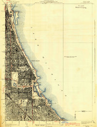
1929 Map of Jackson Park
USGS Topo · Published 1939About this map
Lake Michigan's western shoreline dominates this 1930s-era survey, revealing the dense urban grid and extensive park system of Chicago's South Side. The map highlights a series of world-class cultural institutions along the waterfront, from the northern cluster at Grant Park featuring the Field Museum, Aquarium, and Planetarium, down to the Museum of Science and Industry situated within Jackson Park. The transit-oriented nature of the city is evident in the heavy lines of the Illinois Central railroad running parallel to the coast, serving as a primary artery for the South Side neighborhoods.
Find a feature on this map
40 named features on this map. Tap any name to fly to it.
Don’t see what you’re looking for? This feature index may not catch every label — zoom into the map to look around manually.
Map Details
Editions of this 1929 Jackson Park Map
3 editions found
Other maps of this area

1889 · Chicago
USGS Topo · 1:62,500

1891 · Chicago
USGS Topo · 1:62,500

1892 · Calumet
USGS Topo · 1:62,500

1893 · Calumet
USGS Topo · 1:62,500

1900 · Chicago
USGS Topo · 1:62,500

1900 · Toleston
USGS Topo · 1:62,500

1900 · Calumet
USGS Topo · 1:62,500

1901 · Calumet
USGS Topo · 1:62,500

1901 · Chicago
USGS Topo · 1:62,500

1929 · Calumet Lake
USGS Topo · 1:24,000