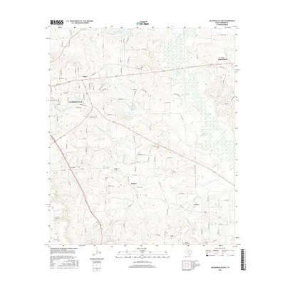
2016 Map of Jacksonville East
USGS Topo · Published 2016About this map
Jacksonville serves as the primary urban center for this portion of Cherokee County, situated at a major convergence of regional roads and highways. The surrounding landscape is defined by its transition from organized municipal streets to a pastoral network of county roads and family-named landmarks. Settlements like Turney, Craft, and Gallatin are clustered along the major transport corridors, reflecting the enduring rural character of East Texas. Notable for genealogists are the numerous burial grounds scattered across the terrain, including the Tilley Cem, Staton Cem, and Jarrett Cem. Hydrological features like Mud Cr and Caney Cr snake through the eastern reaches, while Pine Crest Lake and Turnbow Lake dot the center of the sheet. The presence of Bolton Airport and the complex web of state and county routes underscore the area's role as a regional transit hub.
Find a feature on this map
109 named features on this map. Tap any name to fly to it.
Don’t see what you’re looking for? This feature index may not catch every label — zoom into the map to look around manually.
Map Details
Editions of this 2016 Jacksonville East Map
This is the sole edition of this map. No revisions or reprints were ever made.
Other maps of this area

1937 · Troupe
USGS Topo · 1:48,000

1943 · Troup
USGS Topo · 1:62,500

1943 · Rusk
USGS Topo · 1:62,500

1945 · Rusk
USGS Topo · 1:62,500

1946 · Bullard
USGS Topo · 1:62,500

1948 · Bullard
USGS Topo · 1:62,500

1951 · Jacksonville
USGS Topo · 1:62,500

1953 · Palestine
USGS Topo · 1:250,000

1956 · Tyler
USGS Topo · 1:250,000

1957 · Palestine
USGS Topo · 1:250,000