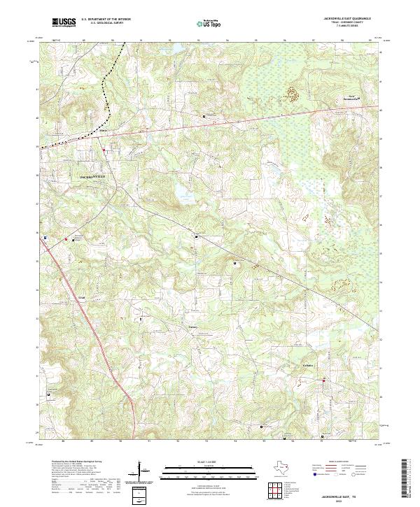
2022 Map of Jacksonville East
USGS Topo · Published 2022About this map
New Summerfield and the eastern outskirts of Jacksonville anchor this survey of the East Texas landscape, where low ridges like Barber Hill rise above a complex network of creeks. Small, established communities such as Turney, Craft, and Gallatin are linked by a dense web of county roads that navigate the headwaters of Mud Creek and Ragsdale Creek. The area is characterized by numerous family and community burial grounds, including the Jarratt Cemetery and Vinson Cemetery, which provide essential touchpoints for genealogical research in this part of Cherokee County.
Find a feature on this map
99 named features on this map. Tap any name to fly to it.
Don’t see what you’re looking for? This feature index may not catch every label — zoom into the map to look around manually.
Map Details
Editions of this 2022 Jacksonville East Map
This is the sole edition of this map. No revisions or reprints were ever made.
Other maps of this area

1937 · Troupe
USGS Topo · 1:48,000

1943 · Troup
USGS Topo · 1:62,500

1943 · Rusk
USGS Topo · 1:62,500

1945 · Rusk
USGS Topo · 1:62,500

1946 · Bullard
USGS Topo · 1:62,500

1948 · Bullard
USGS Topo · 1:62,500

1951 · Jacksonville
USGS Topo · 1:62,500

1953 · Palestine
USGS Topo · 1:250,000

1956 · Tyler
USGS Topo · 1:250,000

1957 · Palestine
USGS Topo · 1:250,000