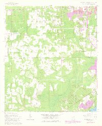
1964 Map of Jacksonville Heights
USGS Topo · Published 1978About this map
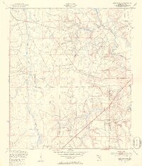
US Naval Air Station (Cecil Field) dominates the western landscape of this mid-century survey, a period when the outskirts of Jacksonville were transitioning from rural wetlands into suburban communities. The Jacksonville Corporate Boundary cuts across the center of the sheet, dividing the developing neighborhoods of Jacksonville Heights and Oak Hill from the more remote southern reaches. Significant water systems like the Ortega River and Black Creek define the topography, while the Seaboard Coast Line railroad provides a critical industrial corridor. Genealogists and local historians will find value in the location of the Federal Hill Cem and local congregations such as Jacksonville Heights Ch. The map also captures specialized infrastructure of the 1960s, including Radio Towers (WAYR) and the residential layouts of Westwood and Enchanted Park.
Find a feature on this map
43 named features on this map. Tap any name to fly to it.
Don’t see what you’re looking for? This feature index may not catch every label — zoom into the map to look around manually.
Map Details
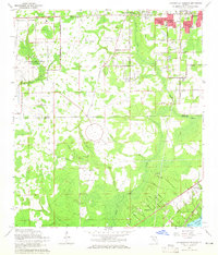
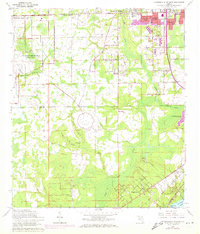
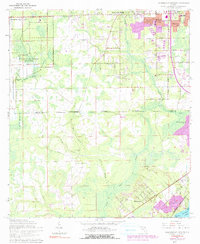
Editions of this 1964 Jacksonville Heights Map
4 editions found
Other maps of this area

1917 · Orange Park
USGS Topo · 1:62,500

1917 · Cambon
USGS Topo · 1:62,500

1918 · Middleburg
USGS Topo · 1:62,500

1918 · Cambon
USGS Topo · 1:62,500

1918 · Jacksonville
USGS Topo · 1:62,500

1918 · Orange Park
USGS Topo · 1:62,500

1941 · Middleburg
USGS Topo · 1:62,500

1948 · Jacksonville
USGS Topo · 1:250,000
1949 · Middleburg SW
USGS Topo · 1:24,000

1949 · Fiftone
USGS Topo · 1:24,000
Featured Places
- Jacksonville, FL
- Oak Hill, Jacksonville
- Westwood, Jacksonville
- Oak Hill Park, Jacksonville
- Ridgewood, FL