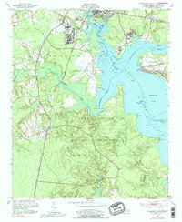
1952 Map of Jacksonville South
USGS Topo · Published 1992About this map
The Camp Lejeune Military Reservation dominates this coastal landscape south of Jacksonville, showing the extensive mid-century footprint of the Marine Corps base. The terrain is defined by the widening New River and its brackish tributaries, including Northeast Creek and Southwest Creek, which carve deep into the low-lying pine forests and marshes. This 1952 survey captures the military infrastructure of the era, notably the Peters Point Field Glider Base situated on a peninsula above the river.
Find a feature on this map
46 named features on this map. Tap any name to fly to it.
Don’t see what you’re looking for? This feature index may not catch every label — zoom into the map to look around manually.
Map Details
Editions of this 1952 Jacksonville South Map
4 editions found
Other maps of this area

1943 · Jacksonville
USGS Topo · 1:62,500

1948 · Maple Hill
USGS Topo · 1:62,500

1948 · New River
USGS Topo · 1:62,500

1948 · Richlands
USGS Topo · 1:62,500

1952 · Camp Lejeune
USGS Topo · 1:24,000

1952 · Jacksonville South
USGS Topo · 1:24,000

1952 · New River Inlet
USGS Topo · 1:24,000

1952 · Sneads Ferry
USGS Topo · 1:24,000

1953 · Beaufort
USGS Topo · 1:250,000

1954 · Beaufort
USGS Topo · 1:250,000