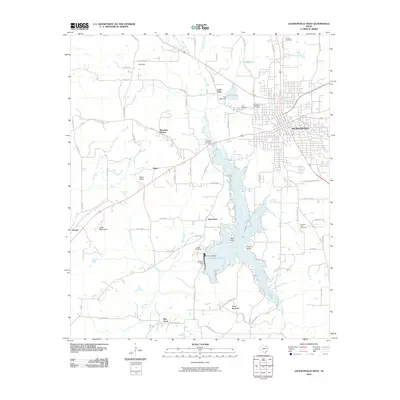
2010 Map of Jacksonville West
USGS Topo · Published 2010About this map
Lake Jacksonville dominates the central terrain, its winding fingers created by the damming of Gum Creek. Along the western shores, the community of New Hope and several prominent points like Oak Point and Piney Point illustrate the residential and recreational development of the late 20th century. To the east, the city of Jacksonville spreads toward the quadrangle boundary, showing a dense street grid that includes the City Cemetery and Resthaven Cemetery.
Find a feature on this map
52 named features on this map. Tap any name to fly to it.
Don’t see what you’re looking for? This feature index may not catch every label — zoom into the map to look around manually.
Map Details
Editions of this 2010 Jacksonville West Map
This is the sole edition of this map. No revisions or reprints were ever made.
Other maps of this area

1937 · Troupe
USGS Topo · 1:48,000

1943 · Troup
USGS Topo · 1:62,500

1943 · Rusk
USGS Topo · 1:62,500

1945 · Rusk
USGS Topo · 1:62,500

1946 · Bullard
USGS Topo · 1:62,500

1948 · Bullard
USGS Topo · 1:62,500

1951 · Jacksonville
USGS Topo · 1:62,500

1953 · Palestine
USGS Topo · 1:250,000

1956 · Tyler
USGS Topo · 1:250,000

1957 · Palestine
USGS Topo · 1:250,000