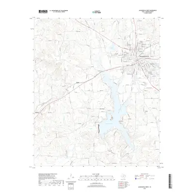
2019 Map of Jacksonville West
USGS Topo · Published 2019About this map
Jacksonville serves as the primary hub of this 2019 survey, showing the city's residential and commercial growth across Cherokee County. The eastern portion of the map is dominated by the sprawling waters of Lake Jacksonville, featuring distinct points such as Oak Point and Piney Point. The landscape is a mix of small settlements and rugged terrain, with landmarks like Luker Mtn and Casey Mtn rising above the creek systems. Several historical burial sites, including Ragsdale Cem, Miles Cem, and Pleasant View Cem, provide essential data for genealogical research in these rural Texas communities.
Find a feature on this map
166 named features on this map. Tap any name to fly to it.
Don’t see what you’re looking for? This feature index may not catch every label — zoom into the map to look around manually.
Map Details
Editions of this 2019 Jacksonville West Map
This is the sole edition of this map. No revisions or reprints were ever made.
Other maps of this area

1937 · Troupe
USGS Topo · 1:48,000

1943 · Troup
USGS Topo · 1:62,500

1943 · Rusk
USGS Topo · 1:62,500

1945 · Rusk
USGS Topo · 1:62,500

1946 · Bullard
USGS Topo · 1:62,500

1948 · Bullard
USGS Topo · 1:62,500

1951 · Jacksonville
USGS Topo · 1:62,500

1953 · Palestine
USGS Topo · 1:250,000

1956 · Tyler
USGS Topo · 1:250,000

1957 · Palestine
USGS Topo · 1:250,000