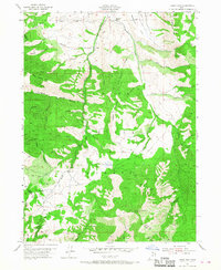
1955 Map of James Peak
USGS Topo · Published 1968About this map
The Cache National Forest dominates this landscape where the Cache Co Weber Co line traverses high ridges and deep canyons. The central terrain is defined by the massive profile of Middle Mountain and the prominent heights of James Peak, overlooking a complex network of drainages that feed into the Bear River. This mid-century survey captures the region during a period of active land management and resource use, evidenced by the presence of the Honey Bee Mine on the western slopes and several irrigation and stock management features like Fourmile Reservoir.
Find a feature on this map
57 named features on this map. Tap any name to fly to it.
Don’t see what you’re looking for? This feature index may not catch every label — zoom into the map to look around manually.
Map Details
Editions of this 1955 James Peak Map
4 editions found
Other maps of this area

1914 · Logan
USGS Topo · 1:125,000

1916 · Logan
USGS Topo · 1:125,000

1954 · Ogden
USGS Topo · 1:250,000

1955 · Paradise
USGS Topo · 1:24,000

1955 · Mantua
USGS Topo · 1:24,000

1955 · Huntsville
USGS Topo · 1:24,000

1955 · James Peak
USGS Topo · 1:24,000

1955 · North Ogden
USGS Topo · 1:24,000

1955 · Mount Pisgah
USGS Topo · 1:24,000

1958 · Ogden
USGS Topo · 1:250,000
Featured Places
- Sundown Condominiums at Powder Mountain, UT
- Powder Mountain, UT
- Weber County, UT
- Cache County, UT
- Box Elder County, UT