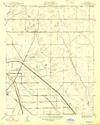
1947 Map of Jamesan
USGS Topo · Published 1947About this map
The agricultural landscape of Fresno County is defined here by a rigid grid of section lines and irrigation infrastructure as it appeared just after World War II. Jamesan and Tranquillity serve as the primary human outposts in a territory heavily modified for water management, dominated by the massive Fresno Slough Bypass and the original Fresno Slough. Transport and logistics are anchored by the Southern Pacific and Colorado Southern railroads, which parallel major thoroughfares like Pacific Avenue.
Find a feature on this map
35 named features on this map. Tap any name to fly to it.
Don’t see what you’re looking for? This feature index may not catch every label — zoom into the map to look around manually.
Map Details
Editions of this 1947 Jamesan Map
This is the sole edition of this map. No revisions or reprints were ever made.
Other maps of this area

1921 · Mendota
USGS Topo · 1:31,680

1923 · Englebrecht Ranch
USGS Topo · 1:31,680

1923 · Biola
USGS Topo · 1:31,680

1924 · Jamesan
USGS Topo · 1:31,680

1924 · Tranquillity
USGS Topo · 1:31,680

1924 · Gravelly Ford
USGS Topo · 1:31,680

1924 · Mendota
USGS Topo · 1:31,680

1925 · Helm
USGS Topo · 1:31,680

1925 · San Joaquin
USGS Topo · 1:31,680

1946 · Tranquillity
USGS Topo · 1:62,500