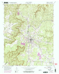
1954 Map of Jamestown
USGS Topo · Published 1979About this map
Jamestown sits atop the Cumberland Plateau, serving as a hub for Fentress County's rural communities during the mid-20th century. The landscape is defined by deep, wooded drainages like Poplar Cove Creek and Crooked Creek that carve into the highland flats. A notable institutional landmark is the Alvin C York Institute, reflecting the local legacy of the World War I hero in his home county. The map reveals a transition in land use, showing traditional homesteads and several small family burial grounds, such as Wood Cem and Crockett Cem, alongside emerging industrial footprints like a Strip Mine and a local Drive-in Theater. Further south, the settlement of Allardt maintains its distinct grid, established by German settlers decades earlier. The network of hollows, including Carpenter Hollow and Branham Hollow, illustrates the challenging terrain that shaped Tennessee's upland settlement patterns.
Find a feature on this map
43 named features on this map. Tap any name to fly to it.
Don’t see what you’re looking for? This feature index may not catch every label — zoom into the map to look around manually.
Map Details
Editions of this 1954 Jamestown Map
4 editions found
Other maps of this area

1895 · Wartburg
USGS Topo · 1:125,000

1896 · Wartburg
USGS Topo · 1:125,000

1897 · Standingstone
USGS Topo · 1:125,000

1898 · Standingstone
USGS Topo · 1:125,000

1929 · Byrdstown
USGS Topo · 1:62,500

1934 · Pall Mall
USGS Topo · 1:62,500

1954 · Stockton
USGS Topo · 1:24,000

1954 · Burrville
USGS Topo · 1:24,000

1954 · Jamestown
USGS Topo · 1:24,000

1954 · Grimsley
USGS Topo · 1:24,000