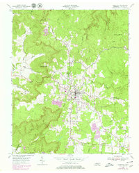
1954 Map of Jamestown
USGS Topo · Published 1979About this map
The Cumberland Plateau town of Jamestown serves as the focal point for this 1954 topographic study, revised in 1979 to show the growth of the plateau's infrastructure. Central to the local identity is the Alvin C York Institute, alongside numerous family burial grounds including Wood Cem, Livingston Cem, and Crockett Cem that document the area's genealogical roots. The landscape is defined by deep incisions like Carpenter Hollow and Campbell Hollow which break the high tableland.
Find a feature on this map
49 named features on this map. Tap any name to fly to it.
Don’t see what you’re looking for? This feature index may not catch every label — zoom into the map to look around manually.
Map Details
Editions of this 1954 Jamestown Map
4 editions found
Other maps of this area

1895 · Wartburg
USGS Topo · 1:125,000

1896 · Wartburg
USGS Topo · 1:125,000

1897 · Standingstone
USGS Topo · 1:125,000

1898 · Standingstone
USGS Topo · 1:125,000

1929 · Byrdstown
USGS Topo · 1:62,500

1934 · Pall Mall
USGS Topo · 1:62,500

1954 · Stockton
USGS Topo · 1:24,000

1954 · Burrville
USGS Topo · 1:24,000

1954 · Jamestown
USGS Topo · 1:24,000

1954 · Grimsley
USGS Topo · 1:24,000