
1953 Map of Jamestown
USGS Topo · Published 1953About this map
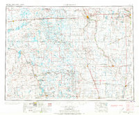
The James River valley serves as the central anchor for this mid-century portrait of southeastern North Dakota, where the regional hub of Jamestown sits at the intersection of critical prairie infrastructure. The landscape is defined by a dense network of major railroads, including the Northern Pacific and the Minneapolis St Paul and Sault Ste Marie, which connected agricultural shipping points like Spiritwood, Medina, and La Moure. Outside the primary settlements, the map reveals an extensive system of water conservation and heritage sites, from the Chase Lake National Wildlife Refuge to the Whitestone Hill Battlefield Park. Local institutions such as the North Dakota State Hospital and the North Dakota Agricultural Experiment Station underscore the area's role as a center for state services and agrarian research during the 1950s.
Find a feature on this map
114 named features on this map. Tap any name to fly to it.
Don’t see what you’re looking for? This feature index may not catch every label — zoom into the map to look around manually.
Map Details
Editions of this 1953 Jamestown Map
3 editions found
Other maps of this area

1894 · Monango
USGS Topo · 1:62,500

1894 · La Moure
USGS Topo · 1:62,500

1894 · Ellendale
USGS Topo · 1:62,500

1894 · Hecla
USGS Topo · 1:62,500

1894 · Savo
USGS Topo · 1:62,500

1894 · Fullerton
USGS Topo · 1:62,500

1894 · Oakes
USGS Topo · 1:62,500

1895 · Lamoure
USGS Topo · 1:125,000

1896 · Columbia
USGS Topo · 1:125,000

1896 · Jamestown
USGS Topo · 1:125,000