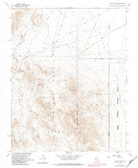
1961 Map of Jangle Ridge
USGS Topo · Published 1984About this map
The Nevada Test Site dominates the western portion of this 1961 survey, revealing a landscape defined by Atomic Energy Commission activity and Cold War defense operations. Military boundaries carve through the high desert, separating Area 9 and Area 10 from the vast Nellis Air Force Range. Infrastructure supporting these restricted zones is visible via the Groom Lake Road and an Underground Telephone Line that cuts across the northern basin toward the Emigrant Valley.
Find a feature on this map
23 named features on this map. Tap any name to fly to it.
Don’t see what you’re looking for? This feature index may not catch every label — zoom into the map to look around manually.
Map Details
Editions of this 1961 Jangle Ridge Map
3 editions found
Other maps of this area

1908 · Kawich
USGS Topo · 1:250,000

1942 · Emigrant Valley
USGS Topo · 1:125,000

1942 · Wheelbarrow Peak
USGS Topo · 1:125,000

1952 · Tippipah Spring
USGS Topo · 1:62,500

1952 · Papoose Lake
USGS Topo · 1:62,500

1952 · Wheelbarrow Peak
USGS Topo · 1:62,500

1952 · Groom Mine
USGS Topo · 1:62,500

1954 · Caliente
USGS Topo · 1:250,000

1954 · Goldfield
USGS Topo · 1:250,000

1955 · Goldfield
USGS Topo · 1:250,000