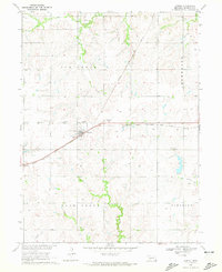
1970 Map of Jansen
USGS Topo · Published 1972About this map
Jansen serves as the focal point of this 1970 field-checked survey, illustrating a classic Midwestern rail-centered settlement in Jefferson County. The town layout is defined by the Chicago Rock Island and Pacific railroad, which bisects the landscape diagonally from northeast to southwest. Cultural and community landmarks are clearly marked, including the Mennonite Ch, Jansen Cem, and a Sewage Disposal facility on the western edge of town.
Find a feature on this map
18 named features on this map. Tap any name to fly to it.
Don’t see what you’re looking for? This feature index may not catch every label — zoom into the map to look around manually.
Map Details
Editions of this 1970 Jansen Map
2 editions found
Other maps of this area

1955 · Lincoln
USGS Topo · 1:250,000

1957 · Lincoln
USGS Topo · 1:250,000

1957 · Plymouth
USGS Topo · 1:24,000

1958 · Lincoln
USGS Topo · 1:250,000

1960 · Fairbury SW
USGS Topo · 1:24,000

1960 · Western SW
USGS Topo · 1:24,000

1960 · Fairbury
USGS Topo · 1:24,000

1961 · Western SE
USGS Topo · 1:24,000
1970 · Harbine
USGS Topo · 1:24,000
1970 · Endicott
USGS Topo · 1:24,000