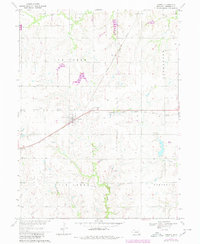
1970 Map of Jansen
USGS Topo · Published 1980About this map
The village of Jansen serves as a central hub in this section of Jefferson County, where the diagonal line of the Chicago Rock Island and Pacific railroad dictates the local geometry of the prairie landscape. Settled patterns of faith and education are evident through the presence of the Mennonite Ch and St Pauls Ch, alongside community landmarks like the Grandy Sch. The map reveals a rural economy structured around watercourses and transport, with Cub Creek and Rock Creek carving through the northern and southern townships. Genealogists can identify localized family and community plots such as Jansen Cem and Bartel Cem. The topography is defined by the gradual drainage into Big Indian Cr, with much of the land marked by fine field and fence lines that illustrate the agricultural organization of the late 20th century.
Find a feature on this map
17 named features on this map. Tap any name to fly to it.
Don’t see what you’re looking for? This feature index may not catch every label — zoom into the map to look around manually.
Map Details
Editions of this 1970 Jansen Map
2 editions found
Other maps of this area

1955 · Lincoln
USGS Topo · 1:250,000

1957 · Lincoln
USGS Topo · 1:250,000

1957 · Plymouth
USGS Topo · 1:24,000

1958 · Lincoln
USGS Topo · 1:250,000

1960 · Fairbury SW
USGS Topo · 1:24,000

1960 · Western SW
USGS Topo · 1:24,000

1960 · Fairbury
USGS Topo · 1:24,000

1961 · Western SE
USGS Topo · 1:24,000
1970 · Harbine
USGS Topo · 1:24,000
1970 · Endicott
USGS Topo · 1:24,000