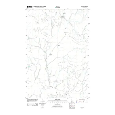
2011 Map of Jaype
USGS Topo · Published 2011About this map
Jaype and Cardiff sit within a landscape defined by timber management and drainage networks in Clearwater County. This area serves as a focal point for the Clearwater Timber Protective Assoc Headqtrs, highlighting the industrial and protective infrastructure required for Idaho's forestry sector. Significant transport routes like Grangemont Rd and Shanghai Rd provide access to higher elevations marked by Summit Lookout and Shanghai Lookout. The map tracks the winding paths of Quartz Creek and Threemile Creek, which flow through the vicinity of Hollywood and the Revling Spur. These labels reflect a mid-century period of established rural settlement and specialized land use, including recreational spots like the Hollywood Recreation Area and Ec Rettig Campground.
Find a feature on this map
38 named features on this map. Tap any name to fly to it.
Don’t see what you’re looking for? This feature index may not catch every label — zoom into the map to look around manually.
Map Details
Editions of this 2011 Jaype Map
This is the sole edition of this map. No revisions or reprints were ever made.
Other maps of this area

1923 · Washington Creek
USGS Topo · 1:125,000

1924 · Weippe
USGS Topo · 1:125,000

1938 · Headquarters
USGS Topo · 1:48,000

1944 · Headquarters
USGS Topo · 1:62,500

1956 · Hamilton
USGS Topo · 1:250,000

1959 · Hamilton
USGS Topo · 1:250,000

1960 · Hamilton
USGS Topo · 1:250,000

1964 · Hamilton
USGS Topo · 1:250,000

1965 · French Mountain
USGS Topo · 1:24,000

1966 · Pierce
USGS Topo · 1:24,000