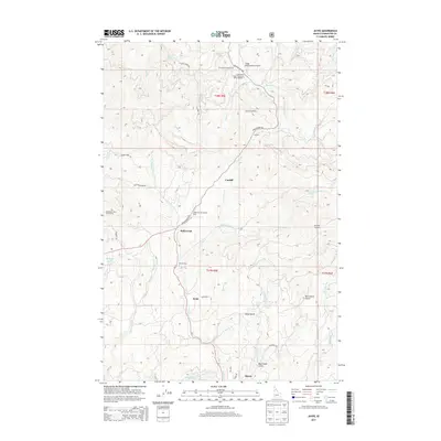
2013 Map of Jaype
USGS Topo · Published 2013About this map
The Clearwater timberlands of northern Idaho appear in sharp relief on this 2013 survey, centered on the historic mining and logging district surrounding Pierce. The landscape is dominated by the industrial legacy of the region, anchored by the Clearwater Timber Protective Assoc Headqtrs and the Cptpa Headquarters Airport. Small settlements like Cardiff, Hollywood, and Jaype mark the transit corridors where Id-11 and Grangemont Rd wind through the creek-cut terrain.
Find a feature on this map
80 named features on this map. Tap any name to fly to it.
Don’t see what you’re looking for? This feature index may not catch every label — zoom into the map to look around manually.
Map Details
Editions of this 2013 Jaype Map
This is the sole edition of this map. No revisions or reprints were ever made.
Other maps of this area

1923 · Washington Creek
USGS Topo · 1:125,000

1924 · Weippe
USGS Topo · 1:125,000

1938 · Headquarters
USGS Topo · 1:48,000

1944 · Headquarters
USGS Topo · 1:62,500

1956 · Hamilton
USGS Topo · 1:250,000

1959 · Hamilton
USGS Topo · 1:250,000

1960 · Hamilton
USGS Topo · 1:250,000

1964 · Hamilton
USGS Topo · 1:250,000

1965 · French Mountain
USGS Topo · 1:24,000

1966 · Pierce
USGS Topo · 1:24,000